
Lime, OR - Abandoned Cement Plant Ruins (click for full gallery)
In mid-June, I was off on another road-trip to the US Southwest, as detailed in my previous blog post, where I talk about shooting with my new Fujifilm X-Pro2 and compared raw conversions from PhotoNinja with Lightroom.
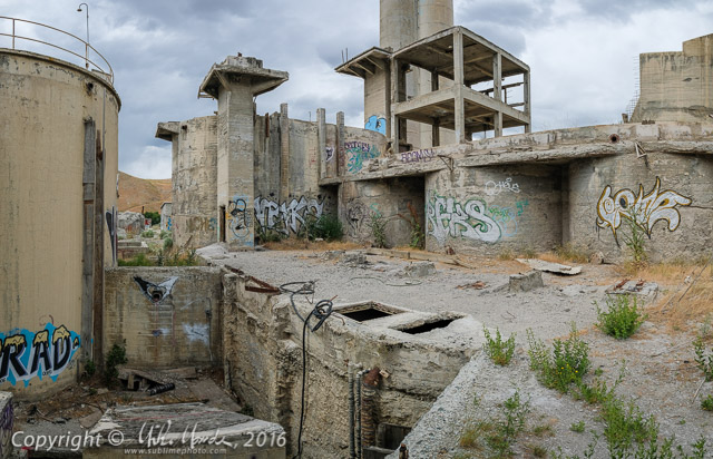
The gallery above has images from the first two days of shooting, starting with the graffiti encrusted ruins of an abandoned concrete plant in Lime, Oregon. As with other recent trip galleries, there are GPS links on the thumbnails of each image (the globe icon at the top left of each slide), so you can see where the shot was taken, give or take a few dozen meters usually. On the first day of shooting, I accidentally had left my camera in JPEG only (was testing how many JPEG-only shots per card for a customer at work, just before I left) and didn't notice until the download to my laptop that evening... D'oh! Luckily the overcast shots generally presented only minimal dynamic range challenges so the JPEGs are fine. Quickly switched back to RAW+JPEG that evening after I noticed though!
The next day, a few hours were spent hiking around the fascinating rock formations near the Danger Point cliffs, south of Westfall, Oregon. Then it was off to find a camp site at the Succor Creek State Natural Area in southeast Oregon. These BLM lands are filled with some amazing rock formations, cliffs, canyons and even "painted desert" areas.
Click to see all the blog postings from my 2016 June Southwest Trip...

1 comments:
The Succor Creek captures are intriguing Mike.
Post a Comment